We woke up early on the morning of March 14th and prepared ourselves for the long day ahead: a 19.4 km journey through some of New Zealand’s most dramatic and unique landscapes. Considered to be the best one day hike in the country, the Tongariro Alpine Crossing traverses active volcanoes and brings visitors up close and personal with both ancient and recent lava flows, rugged alpine wilderness, shimmering lakes, geothermal steam vents, and lush native forest. The most recent eruption in the area occurred as recently as November 2012 and parts of the park still show lots of signs of activity.
Our journey began in the wee hours of the morning in Taupo. Usually I’m not the kind of person who enjoys getting up at 5 AM (I’m sure no one does), but when there’s a fun adventure planned for the day I might as well be a kid waking up on Christmas morning. For the both of us, doing the Tongariro Crossing was high on our lists of things to do in New Zealand, so we wasted no time getting up and ready. After devouring a quick breakfast, we marched out and hopped on the shuttle bus packed with thirty or so other hikers fighting early morning grogginess. As we drove along the Desert Road toward the park, the first rays of light began to appear on the horizon, revealing a blue sky day. Perfect.
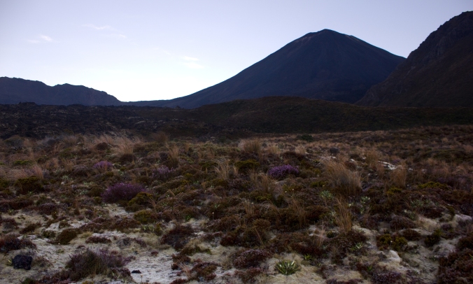
Upon arrival at the trail head, what was a bus full of sleepy hikers suddenly became alive with activity as people hopped off, hastily gathered their gear, and started off down the path. The first section of the trail is rather easy as it leaves the car park, gradually rising through fields of alpine shrubs and grasses to a place called Soda Springs. As we got going, we noticed a lot of people seemed to be in a hurry. We’re pretty fast walkers to begin with, so we were a bit surprised to see people literally jogging past us then suddenly slow down as they got ahead. Eager to get to the top first maybe? Or maybe we just smelled. I don’t know. It was also pretty amusing seeing the “hiking attire” some people chose to wear that day–everything from skinny jeans, to vans, and yoga pants. Not really the proper outfits for hiking, especially in an environment where the weather can turn in a very short amount of time. We eventually caught up with all the speed demons once we got to the bottom of what’s called “The Devil’s Staircase”. From this point it’s a short, but steep, ascent up volcanic terrain that slows everyone’s pace down.
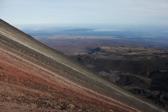
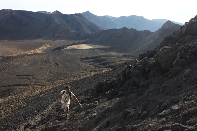
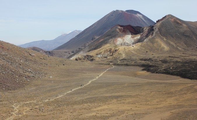
By the time we reached the South Crater, the sun had fully risen–casting its light upon the vast Central Plateau beneath us. We could see as far as Mt. Taranaki, a nearly perfect cone-shaped volcano some 140 kilometers away. From the entry to the South Crater, we took a detour off the beaten track and started the grueling climb toward the summit of Mt. Ngauruhoe. Also known as Mount Doom, it was the stand-in for the fictional volcano in the Lord of the Rings. The slope up the side of Ngauruhoe is nothing but loose ash and sharp volcanic rock. So like two little hobbitses, we climbed up Mount Doom–at times using both our hands and feet. The initial part of the climb was a difficult trudge; we would take two steps up only to slide down a step every time. In some places we found ourselves ankle deep in the ash, filling our shoes. Fortunately, we managed to reach a rock formation about 1/3 of the way up the mountain that provided solid ground to climb on most of the rest of the way to the summit.
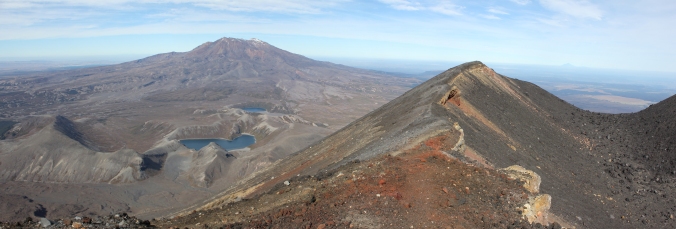
Upon arrival at the summit (2291 meters | 7516 feet), we sat down at the edge of the crater rim and had lunch while enjoying the incredible view. We could see much of the rest of the track and Lake Taupo to the north, along with views of the larger Mount Ruapehu to the south. As a Lord of the Rings fan, I even ceremoniously tossed a small plastic ring that I had been carrying around for a while into the crater. Normally it can get very cold and windy up at the summit, but that day it was so calm and peaceful. Not too hot, not too cold, and very little wind. It was the calm before the storm as a cyclone was due to hit the country several hours later. We were very lucky to have been blessed with such a fine day.
Going down Mt. Ngauruhoe was much easier than going up. The loose ash enabled us to “moon walk” down the slope, putting pressure on our heels and sink into the scree with each step. Similar to running down a big sand dune. There was a close call at one point, when a bowling ball sized rock came loose from somewhere above and came hurling down within a few feet of us. Fortunately, the hikers who dislodged it called out “rock!” in time for us to get out of the way.
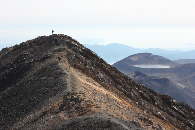
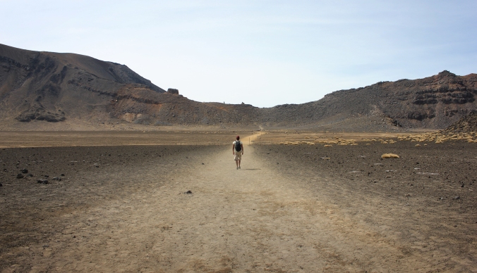
After a successful descent, we wandered back to the main path and continued on with the crossing. The South Crater basin is perfectly flat and was probably the easiest portion of the track. It was a short traverse and we soon arrived at the base of the Red Crater. This is considered the steepest part of the track, but having just climbed Mt. Ngauruhoe it was a walk in the park. Okay, so it was still quite of a workout…a bit exposed as well with two big drop-offs on either side of the path. At the top we were greeted by a large, gaping hole in the ground–the Red Crater. The highest point on the main track at 1886 meters (6187 feet), we let out a sigh of relief knowing that it was basically all downhill from here until the end. From here we began the descent down to the enchanting Emerald Lakes below us–a trio of vividly blue-green lakes whose colorful hue sharply contrasted with the surrounding stark volcanic landscape.
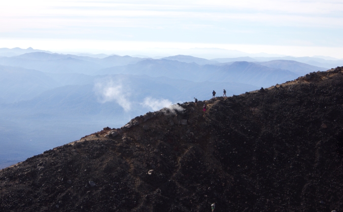
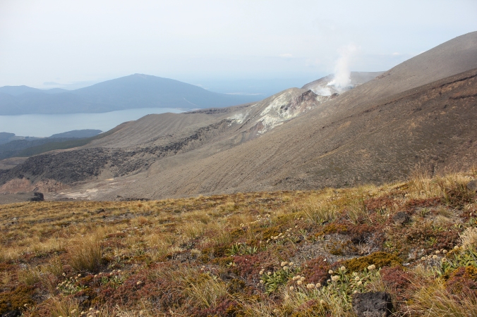
We took a long break at the lakes and wolfed down the rest of the food we had brought. The water looked so inviting. We thought about going for a swim, but considering all the sulfur and who-knows-what-else was going on in there, we opted to remain dry on shore. Continuing on, we walked across another flat basin known as the Central Crater, past a rather large lake, and began our descent towards the car park. This section of the trail was previously closed to the public in the aftermath of the 2012 eruption, but has since been reopened. There is still some activity going on here, however. As we walked through the alpine valleys, we could still see clouds of steam and gas rising out of the hillside just a kilometer or two away.
We eventually reached a resting point at a hut with some restrooms just above the treeline. Here, we saw a sign saying the car park was only 45 minutes ahead. Should be a piece of cake right? We should get there in plenty of time before the last bus. That’s what we thought, but we were terribly wrong. The next 45 minutes might as well have been all of eternity. Physically, this portion of the track wasn’t a difficult at all, but mentally it just seemed like it went on, and on, and on. Shortly after leaving the shelter, the trail descends into the woods and there’s no clear view of exactly how far the car park is. We would go around one corner, thinking we would see the bus there, only to find more trees and dirt path to tread on. We had been walking with a German guy and a Dutch girl most of the day and all four of us started getting worried that we would miss the last bus. We weren’t really keen on walking another 100 km back to Taupo after finishing the track, so we ran. We ran for what seemed like forever until the end of the trail suddenly appeared, just in time to hop on the last bus!
The ride back to Taupo was all a haze. We were dead tired by the time Servan and I finally made it back to our hostel. I vaguely remember even eating dinner. Upon reaching our room, we both crashed and ended up sleeping for 12 hours–a good, long rest after a day in the “land of Mordor”.
——————————————————–
Doing the Tongariro Crossing was probably the absolute best thing I’ve done in New Zealand and I couldn’t have asked for a better day or better company to do it with. It’s a definite must do on anyone’s Kiwi experience! Here are a few tips for any future hikers:
- Bring plenty of food and water. The only water that’s safe to drink on the track is whatever you bring in with you.
- Expect the worse. Be prepared with proper clothing for any kind of weather conditions. In the mountains, it can be hot and sunny one moment but then turn freezing cold with blowing snow in a short amount of time. Even if it’s supposed to be a nice day, it’s better to have your raincoat in a sudden rainstorm than not.
- Shoes: Boots are definitely a good option if you have them. We made it through just fine in running shoes.
- Be sure to wear sunscreen! With a lack of ozone in the atmosphere above New Zealand, the UV rays here are stronger than most other parts of the world. Most of the track is out in the open with no shade to protect you.
- If you go in the winter or early spring (June-October), be aware that there can be snow on the mountain requiring the use of crampons and an ice axe.
- It might also be a good idea to have a first aid kit with you. It would be really hard not to slip and fall at least once on the trail, especially with all the loose dirt and sharp rocks on the trail.
- Be mindful of the weather and check the forecast before you go. MetService is a good source.
- If you need to book a bus pick-up to the park, make sure you do so at least the day before. You can do this at any hostel or iSite. Bus fares generally range from $20-$65 depending on where you get picked up from. Staying in towns close to the mountain, like National Park, will be a cheaper ride.


What super writing, and super pictures! Thanks so much for sending this account. You definitely have talent!
Pingback: My Favorite Places In The World | The Crossroad