I’ll never forget the first time I saw Mount Everest. It was on day three of my trek to Everest Base Camp, on a ridge high above the Sherpa village of Namche Bazaar. We had arrived in Namche the day before, socked in by a thick cloud cover. Nearly all trekkers making their way to Everest stay at least two nights here to rest and acclimatize. To better adjust to the altitude, people make the most of their free day by making a popular day hike to Khumjung, a smaller village above Namche. We set out for the day after breakfast and started the steep uphill climb from right outside our guesthouse.
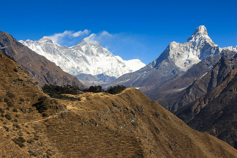
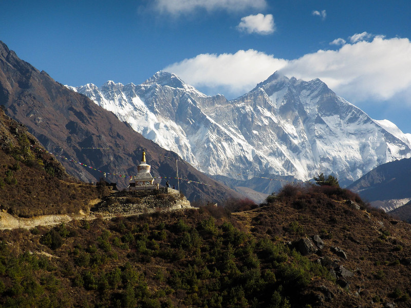
The day was an absolute stunner. Being December, the air was cold and crisp, but the skies were unbelievably clear and so deeply blue. I recall being able to make out every ridge and crevice on the snowy mountains in the distance as we made our ascent. Weather-wise, it couldn’t have been any better. Together with two fellow solo travelers I had met on the first day of the trek, we marched our way up the steepest section. Eventually the slope transitioned into a more gentle climb through yak pastures and the odd little stone house. After about an hour, we made our way over the last small knoll–and there it was. From this viewpoint, you have a remarkable sweeping panoramic view of the Khumbu Valley, home to some of the highest mountains in the world. Peaking out behind Lhotse, another Himalayan giant and the fourth highest point on Earth, the summit of Everest rose high into the dark blue sky. It didn’t tower over the other nearby peaks like I thought it would, but one could still easily point it out. On this day, the winds were calm and gentle from where we were standing. But at 8,848 meters (29,029 feet), the jet stream was slamming into the mountain’s distinct black pyramid-shaped summit, leaving a long wispy trail of snow and ice being blasted off by hundred mile an hour winds. It was hard to believe I was actually standing in the shadow of the highest point on Earth–the roof of the world. I’ll never forget that moment.
Kathmandu (elev. 4953 ft/1400 m)
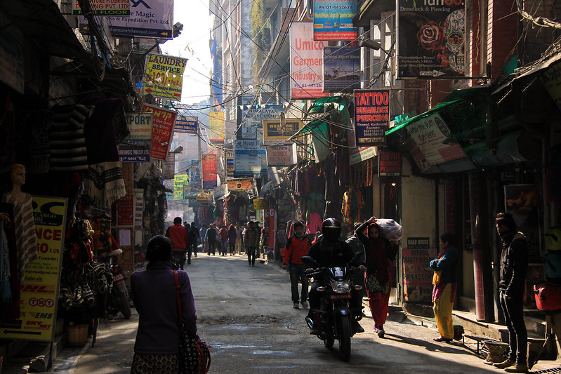
My journey in Nepal began in the bustling capital city of Kathmandu. Having been just traveling through Southeast Asia for the past three months, the crazy driving, congested streets, and hazy air pollution that hung over the city was nothing new to me. What was new was the slight chill in the air. Being early December in the foothills of the Himalayas, I had left behind the the heat and humidity of the tropics. Instead the days were cool and dry–and I was freezing. By cool, I mean it was probably still 70 degrees (21 C) during the day, dipping down into the low 50s in the evenings. But after 2 years of chasing summers, this was the coldest I’d felt in a long time. Living the past year in Australia, my wardrobe mostly consisted of shorts, tank tops, and a pair of flip flops. It was time to trade it all in for some warmer clothes.
Luckily, Kathmandu is a backpacker’s dream when it comes to shopping for trekking gear and clothing. Particularly in the district known as Thamel, which is one of the main tourist areas in the city, where the narrow dusty streets are lined with shops selling backpacks, sleeping bags, trekking gear, wool hats, scarves, and knock-off North Face jackets. I spent a few days in the city getting adjusted and prepared, shopping around for some new warm clothes and getting some things I needed before starting my trek. Since I was going alone without the assistance of a trekking company, I had to organize my permits and flights on my own, which turned out to be easy enough.
In order to do any trek in Nepal, tourists must first obtain a tourist card (TIMS card) from a either a travel agency or from the Nepal Tourism Board in Kathmandu, which essentially is a record of your travel plans. In case of an emergency, the government can keep track of your whereabouts in the country. I went to the Nepal Tourism Board for this since I could also get my national park entry permit there. Between the two, the TIMS card was 2400 rupees (about $22) and the park permit came out to be 3000 rupees ($28). Not the cheapest, considering how cheap everything is in Nepal (which is pretty dirt cheap), but it’s necessary for anyone wishing to go trekking.
Some other miscellaneous things I shopped around for to prepare for the trip included Diamox (altitude sickness pills), baby wipes (because there are no warm showers up in the mountains, and being gone for two weeks you gotta stay clean somehow!), heaps of Snickers bars (gotta load up on the sugars and protein when you’re burning all those calories), trekking poles (only $8 for a pair!), and best of all a nice big puffy down jacket I scored at a shop for only $50 (to this day it’s still the warmest jacket I own, and I still happily wear it on cold winter days). Also since there are no ATM machines on the trail nor any means to pay for anything by card, you have to take a ton of cash with you on the trek. I took out about 32000 rupees, or roughly $300. Enough for 2 weeks worth of food and accommodation (which gets expensive the higher and more isolated you get). For 14 days of trekking, I averaged out at about $18/day for everything, not including the cost of the flights. I also packed my handy water bottle, which has a strong filter straw to purify the tap water that I could at tea houses along the way. This not only saved money on buying plastic water bottles (again, things get expensive the higher up you go as it all has to be carried in on someone’s back) but also reduced the amount of litter I was bringing.
Having gathered all the essentials for the trip, packing and repacking to make sure I had everything prepared, I only felt somewhat ready. I had to wake up at 4:30 the following morning to catch my flight to Lukla, but I found difficulty sleeping that last night in Kathmandu. Deciding to go on this trek independently without a guide or tour group was a choice I knew was a bit unconventional, but I was counting on finding other solo travelers to join. Having only been 9 months since the devastating 2015 earthquake that rocked the country, tourism in Nepal had fallen drastically. My hotel was nearly empty. During my first few days in Kathmandu, I hadn’t really met any other backpackers, other than a nice Canadian I had dinner with on my last night. He had just finished his trek and insisted that there were lots of solo travelers taking on the EBC to meet. This was at least assuring to hear.
Day 1: The Crazy Flight to Lukla and the Walk to Phakding (elev. 8562 ft/2610 m)
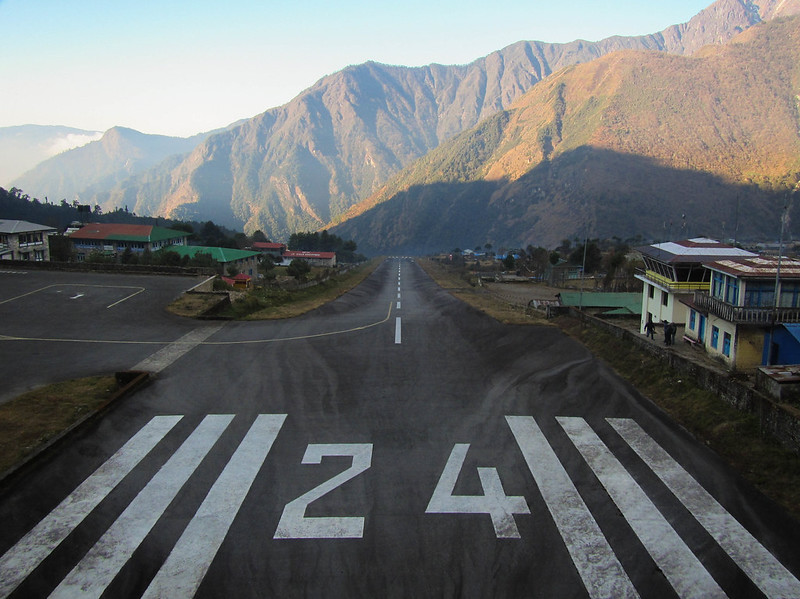
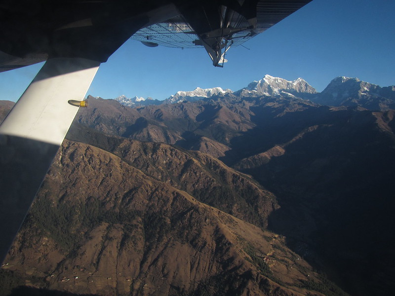
Getting in a whopping 3 hours of sleep, I actually somehow felt quite energized when I woke up. With no one out on the streets at that hour, getting to the airport took no time at all. Before I knew it, I was boarding a tiny de Havilland Twin Otter aircraft, crammed in with about 15 other people. Soon enough we were climbing out of Kathmandu into the thin mountain air and set a heading for our destination about 30 minutes away: Lukla. Having read articles and seen Youtube videos about this flight titled “World’s Scariest Airport“, this was a major portion of the trip that I was both really excited and nervous about.
Lukla is a busy little village right at the start of the EBC trek and serves as the gateway to the Everest region. Walking there from the nearest road takes 5 days, so most people opt to fly in to the town’s tiny airport. The runway itself is only 1730 ft (527 m) long and is not flat at all–it’s literally perched on the side of a mountain on an 11.7% gradient. With a wall of rock sitting at the far end of the landing strip, planes can only fly in and out in one direction, using the forces of gravity from the slope to speed up for take off and slow down for landing. Due to several crashes in the past, flights only take place when the weather conditions are favorable and visibility is good. Rising out of the cloud of smog hanging over Kathmandu, the morning skies were crisp and clear. The view from my window of the sunrise over the Himalayas was breathtaking. We passed over hilltops, deep ravines and valleys, roaring rivers, and in the distance massive snow covered peaks lined the horizon and seemed to go on forever. A wondrous sight that distracted me from the nerves I had earlier upon take off wondering if I’d ever get back on the ground again safely.
Our 30 minutes in the air flew by quickly and before long we were on final approach to Lukla Airport. From my seat, I could see through the cockpit window–it literally looked like we were going to fly straight into the side of the mountain. Eventually what looked like the shortest runway in the world came into view. Touching down, the pilot immediately threw on the brakes and within 5 seconds we came to a near stop before the rock wall and rolled onto the tarmac. As we exited the aircraft, 2 other planes arrived behind us. Within 10 minutes, the planes were unloaded, reloaded with new passengers and cargo, and were rumbling down the runway back to Kathmandu. Incredible. The noise of the prop engines soon faded out and we were left to nothing but silent mountain air.
Somehow my backpack and that of a fellow American from Alaska were the only ones that ended up on the last plane in, so we had to hang around the airport until the next fleet of planes arrived and dropped them off. He was also traveling solo and we clicked pretty well, so from the start I had a hiking buddy and didn’t have to walk by myself! In fact on that first day we met a couple other people who were doing the trail independently, and throughout the duration of the trek I was never really alone. Since everyone is going in the same direction at the same pace, you see familiar faces day by day. After the first few days, our group had grown to include a Dutch guy, a woman from Jordan, an Australian couple, a Thai guy and his guide, among several others we saw frequently. It was quite the international crowd!
Passing through the shops of Lukla (which was so touristy it even had it’s own unofficial Starbucks), the walk to Mount Everest began with a gentle downhill stroll. Even without a guide, following the trail was easy enough to navigate on our own. For the most part it was pretty straightforward, but at forks and other spots where you needed them, there were signs pointing out the right direction. After three hours of following the milky blue waters of a mountain river, we arrived in the village of Phakding and found a guesthouse to stay the night in for only 300 rupees (less than $3). That first night was the best night of sleep I had on the trip. From that point on the higher we went, between the thinning of the air and freezing temperatures at night, it became much more difficult to get rest.
Day 2: Namche Bazaar (elev. 11,286 ft/3440 m)
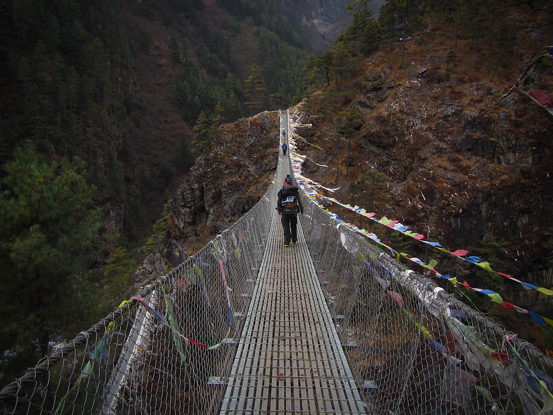
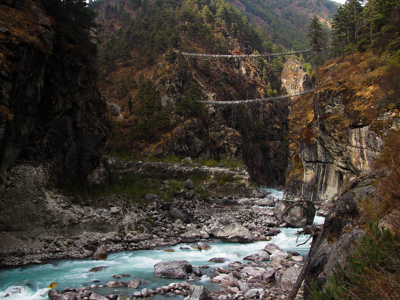
The following morning after a breakfast of tea and Sherpa bread, we carried on with our first hill day. During the night clouds had rolled in so the warm sunny valley we had walked through the day prior was now cool and misty. We continued following the river upstream, occasionally crisscrossing our way to the other side via long metal rope bridges. After a couple hours, we arrived at the park border and checked in with the officer. While he was processing my information, I noticed on the wall in the back of the office a chart that listed visitor numbers month by month, year by year. The number of people visiting the park had been steadily increasing throughout the years, but this year, following the massive earthquake that had taken place that April, the numbers had tanked to nearly half. It was pretty staggering to see how much the earthquake had influenced tourism in the country, even in areas like the Khumbu Valley where the effects weren’t as severe.
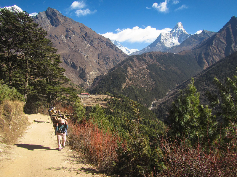
After passing through the park gate, we walked onward toward the base of Namche Hill. All along the way since we had left Lukla the day before, we had been passing numerous Sherpa people carrying heavy loads up and down the trail. Since there are no roads here, everything has to be carried in by yak or on the backs of human beings. Some of these porters were carrying ridiculous loads–bundles of 2x4s, metal doors, and even once we saw a guy carrying a porcelain toilet. On average, porters carry up to 80 pounds strapped to their heads and backs delivering supplies and materials to villages and communities all throughout the region. This made my 14 pound backpack look like a little handbag.
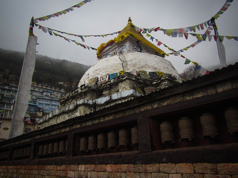
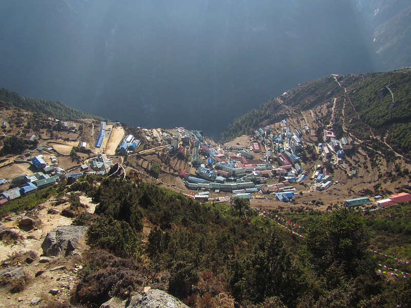
After about two hours of steep climbing through the forested mountainside, we finally stumbled into a very foggy Namche Bazaar. This is the largest settlement in the Khumbu region and Sherpa capital. The narrow stone streets are all lined with hotels and guesthouses, shops selling more trekking gear, bars, restaurants and coffee shops. During the busy peak season the town can accommodate several thousand people, but in cold December post-quake, the town was quite. We booked ourselves a couple of nights into a big three story guesthouse that was pretty much empty for about $2 a night.
Day 3: “Rest” Day – First View of Everest (12,401 ft/3780 m)
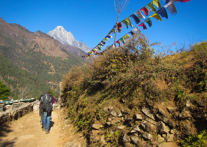
As previously stated, nearly everyone on the EBC who makes it to Namche Bazaar and wishes to go higher stays an extra day to acclimatise. If you go up too quickly, you risk getting altitude sickness which is no fun (I had it once before while in the Andes in Ecuador and it’s no fun. Imagine having the worst hangover for three days). It’s best to acclimatize by going up high during the day and then sleeping at a lower altitude at night, so we decided to climb further up the hill behind town to visit the nearby village of Khumjung.
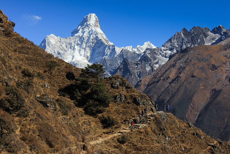
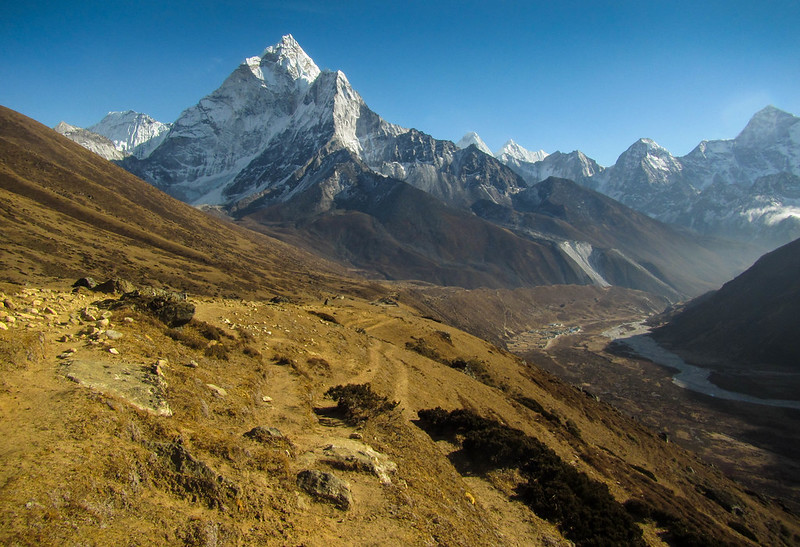
The cool, misty clouds from the day before had lifted so when we woke up we were greeted with an amazingly clear blue sky and visibility was absolutely perfect. It took a little while getting up the hill–not because we were too tired, but because we were constantly distracted by the view the whole way up. Eventually we arrived at the top of the plateau where we were greeted with our first view of Everest as well as other notable Himalayan giants, including the very prominent and beautiful Ama Dablam. Nearby was the Everest View Hotel, which at 12,400 feet claims to be the highest in the world. We stopped here to have a quick lunch and warm up a bit while enjoying the views on the back patio.
Afterwards we carried on doing a loop through the nearby Khumjung village. I had heard rumors that there was a monastery somewhere around the village that housed a supposed yeti scalp, but we never found it. We had spent most of the day out hiking around so we were pretty beat by the time we wandered back into Namche. So much for a rest day. We walked into a bar that was showing reruns of Everest documentaries and movies. It was also the only place I found on the trail that had free WiFi so I sent off a few last messages to friends and loved ones back home.
Day 4: Tengboche (12,700 ft/3870 m)
After a “restful” two nights in Namche, we carried on to the next village–Tengboche. This was meant to be a long day, with 6.4 miles (10.4 km) of walking up and down mountains. The distance wasn’t too bad, the annoying thing was that to get to Tengboche we had to hike back downhill to the river and then climb all the way back up to the top of the ridge where the village sits. It was a long day that took about 6-7 hours.
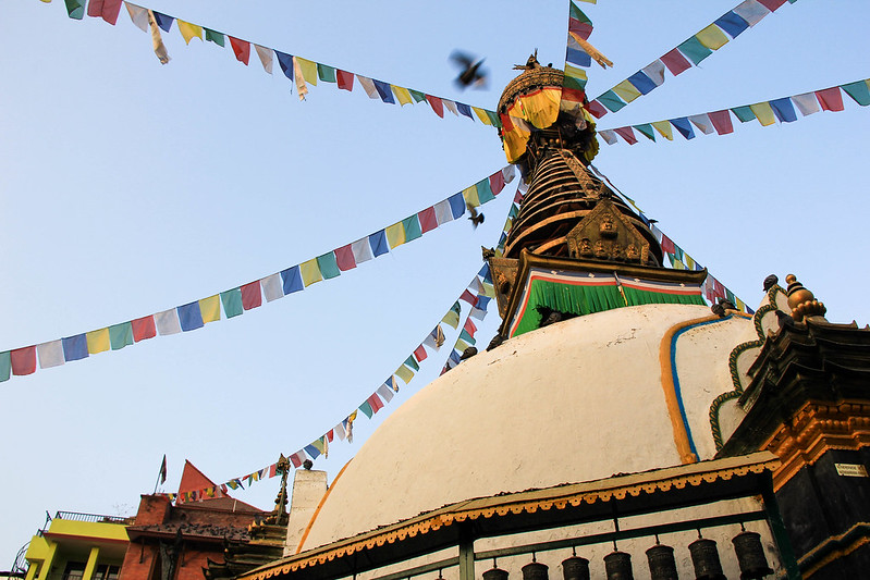
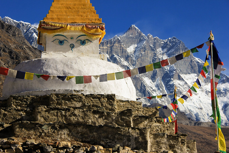
Shortly after leaving Namche, we soon came upon a stupa (a dome-shaped structure serving as a Bhuddist shrine) memorializing Tensing Norgay, a Nepalese citizen from the Khumbu region who, along with New Zealander Sir Edmund Hillary, led the first successful ascent of Mount Everest in May 1953. The memorial was adorned in lines of colorful prayer flags, slowly flapping in the gentle breeze, in plain view of Everest’s summit. It was a peaceful place for a break.
The first portion of the day was actually really nice. The descent back to the river was mostly gentle–more of a traverse across the ridge. Being above the tree line, we had stunning views of the Khumbu Valley for a good portion of the walk. Eventually we got to a fork in the road and we steeply descended downhill toward the river. Along the way, we encountered several groups of trekkers returning from Everest. Their faces showed signs of utter fatigue and weariness–a foretelling reminder of what was to come and that about a week later we’d be making the same grueling uphill climb back.
After what seemed like an eternity, we finally arrived at the river and took a long break eating lunch at a little cafe in the village. Crossing the river was yet another classic Nepali-style swing bridge (we had crossed several the first few days). We bathed in the sun, we watched a yak train, a common sight along the trail, make its way over the bridge. I thought all the swinging rope bridges looked sketchy, but it was assuring to know that if the bridge could hold up all those yaks it could certainly hold 150 pound me.
After lunch and lazing about in the sun a lot longer than we probably should have, we crossed the river and started the slow uphill climb for the next hour and a half. Despite being December, when the sun was out it actually got quite warm, especially going up hill. We peeled off our layers and slowly made the dusty, sweaty climb up the hill stopping occasionally to snack on Snickers. By the time we made it to the top, the clouds had started to move in again and what was a mostly warm sunny, blue sky day quickly turned into a cold mist. We each booked a room in one of the big guesthouses where everyone else was staying at. My room was north facing and absolutely freezing, so I piled on all the layers I could find in my pack.
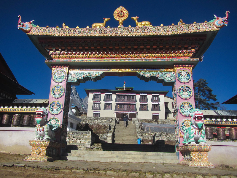
The hill-top village is well-known to be the home of the largest Bhuddist monastery in the Khumbu region, Tengboche Monastery. Joining the rest of the group outside, we all walked over to the large monastery to watch the monks do a meditation ceremony. We all sat down along the wall of a large room, the air heavy with the scent of incense. In the middle of the room were dozens of monks sitting in rows slightly hunched over while they chanted and played their instruments. The vibe and atmosphere was somewhat haunting, but in a good way. It was an intriguing spectacle to watch. The room didn’t have any heating however, and it was absolutely freezing. Since we had to take our boots off and leave them outside, my feet felt like bricks. It also appeared that a few of the monks were sick. One had a horrible cough. It made me feel a little sorry for them that they were exposed to the damp and cold all the time.
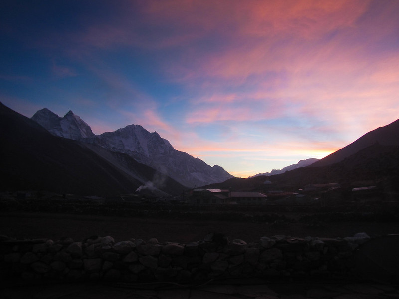
Day 5: Dingboche (14,469 ft/4410 m)
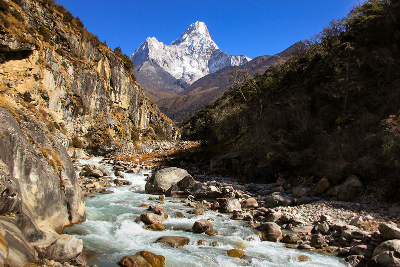
Day 5. Woke up from the coldest night yet (and it only got colder from there). There’s no heating in the rooms in any of the guesthouses along the way. It was hard getting out of my sleeping bag as my room felt absolutely frigid when I got up. My water bottle actually had little bits of ice floating around in it. The only place to warm up was around the stove in the dining area downstairs, which we all would huddle around and socialize while waiting for breakfast. Once breakfast was done, we headed out for another long day of walking. The morning fog broke just in time as we were leaving, the sky opening to another crystal clear blue day. On this day, we’d wander up further into the valley, right in the shadow of Ama Dablam. Everest may be the highest in the world, but Ama Dablam is seriously one of the most majestic mountains in the Himalayas.
Crossing the 4000 meter mark, I could definitely notice a difference in my breathing and overall energy levels. I’m naturally a fairly fast walker and at sea level I can walk for hours and hours without getting tired. Up here, my pace was much slower and I needed to take a break every mile or so. But given the remarkable views everywhere, a break was really necessary to take it all in properly! Aside from being wide-eyed and in awe of the scenery and making a new “friend” with a stray dog that had followed us all the way from Tengboche, the rest of the day was pretty mundane. Nearly 7 miles (11 kms) later, we rolled into Dingboche later in the afternoon than we usually did. Luckily Dingboche is wide out in the open on the valley floor, so with the sun still up we had some time to warm up a bit and relax before sunset.
Day 6: “Rest” Day
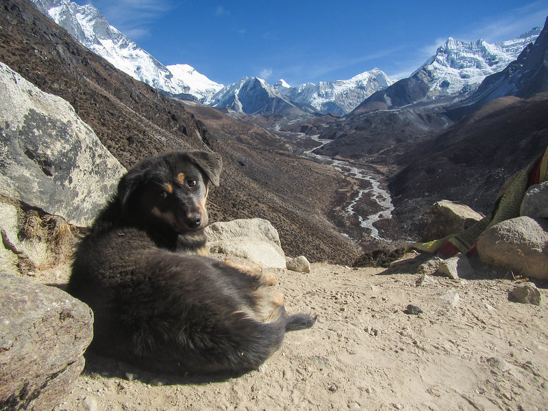
Now having ascended 3500 feet (1000 m) over the past two days, it was time for another rest day to acclimatize. We still spent a portion of the day going out and hiking up to the top of one of the nearby hills, but it was not nearly has strenuous as we did on our rest day in Namche. When I arrived at the top of the hill, I found the little black dog that had followed us from Tengboche the day before. That little guy was everywhere! I was finished with my morning hike before noon and spent the rest of the day actually getting some well needed rest, hanging out in the common room and catching up on some reading (I had bought a copy of Into Thin Air while in Namche, a fitting book to read while hiking to Everest).
I forget what the name of the guesthouse we stayed in was called, but it by far had the warmest stove of anywhere on the trek, which we all happily huddled around. There really wasn’t much to do in the in the evening except talking and playing card games (I became really good after spending endless hours playing card games like President in the evenings in Nepalese guesthouses). With no Internet, it was actually quite liberating being disconnected and off the grid for a few weeks. Everyone was actually interacting with another rather than sitting off in a corner somewhere glued to the screens of their phones. The camaraderie between my fellow trekkers and Sherpas is something I really miss about Nepal.
Day 7: Lobuche (16,210 ft/4940 m)
Trying to catch up on as much sleep as possible, I had a late start on this day and ended up walking alone for half the day. The first portion of the trek was pretty easy, crossing a big plateau through grassy fields where yaks roamed and grazed. Eventually I caught up with my friend from Alaska that I had met at the airport and we trudged onward to our lunch spot at a guesthouse settled right at the base of a big steep hill that we’d have to climb. I was already feeling a headache coming on that that day from the altitude so I had started taking Diamox pills to ward it off. We took an extra long lunch break, drinking mint tea and eating garlic soup (which apparently also helps with the altitude).
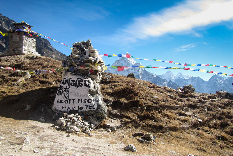
The rest of the day was exhausting. Now at over 15,000 feet (4600 meters), my 14 pound backpack seemed to weigh like a ton. My steps became slower and breathing heavier. We slowly trudged up the hill. Not wanting to overdo ourselves with the altitude, we took a short break every few minutes. After about an hour we finally reached the crest of the hill and took a break. Nearby I noticed several stones decorated with prayer flags, painted and engraved with names of those who had lost their lives on Everest. Among the names were some I had recognized from the book I was currently reading, including Seattle climber Scott Fischer who was one of 12 people who died in a single night during a blizzard in May 1996.
Beyond the Everest Memorial, we reached the toe of the Khumbu Glacier, which flows down the valley from somewhere around the 25,000 foot level on Everest, making it the highest glacier in the world. The last 45 minutes or so of the day was spent following the glacier to the pit stop of the day, Lobuche. The clouds had moved in again around this time and aside from the sound of our breathing and footsteps, everything was eerily silent. Occasionally you could hear the thunderous rumble and groans of ice breaking and shifting, which echoed through the valley. By the time we reached Lobuche, I was dead tired. I tried to refuel on Snickers bars and momos (Nepalese dumplings) while rehydrating on tea, but was starting to lose my appetite (especially when you’ve been eating the same meals for a whole week). I didn’t stick around for long in the evening playing cards with everyone else. Instead I went to bed pretty early, bundled up in all the clothes I had to keep warm.
Day 8: The High Point – Kala Patthar (18,514 ft/5643 m)
Today was the day when we would reach the highest point and spend the night in the small village of Gorak Shep. After another cold, unrestful night’s sleep the night before, I had another late start getting out the door. Despite being on Diamox, I still had a headache and I tried to stay rehydrated on several cups of tea. Everyone else had left by the time I finally started walking.
I made the effort not to overdo myself on the last day of gaining altitude. My Alaskan friend was feeling pretty ill so he went back down that day. The pace was pretty slow going. For the past several days helicopters had been flying overhead occasionally. None of us were really sure if they were just transporting supplies or evacuating injured trekkers, but according to one of the Sherpas we met along the way, the latter wasn’t all that uncommon. Altitude sickness (acute mountain sickness) is commonly experienced by visitors who aren’t accustomed to the lack of oxygen at altitude. In rarer cases, high-altitude pulmonary edema (fluid accumulation in the lungs) also poses a risk to even the healthiest of climbers. Deaths on the EBC itself are uncommon, but not unheard of. This is why rest days and acclimitization is so important.
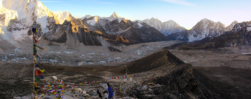
I arrived in Gorak Shep around 2:00 pm and dropped my bag off at one of the guesthouses and rested for about an hour after lunch. Gorak Shep, one of the highest settlements in the world, was more like a few buildings scattered across a big dusty field. On the opopsite side of the field is the base of Kala Patthar, a large hill that is usually the highest point that trekkers go on the EBC trek. When I felt rested and energized again, I set off across the field and began the final ascent.
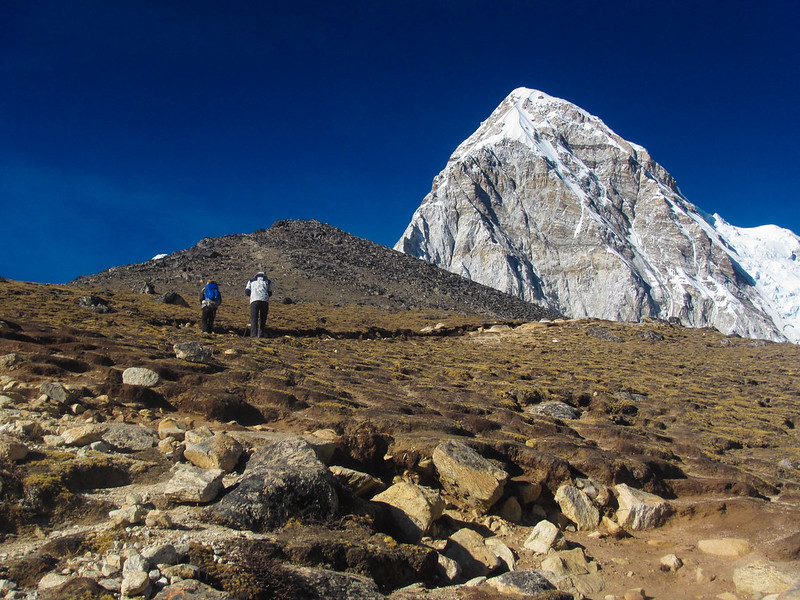
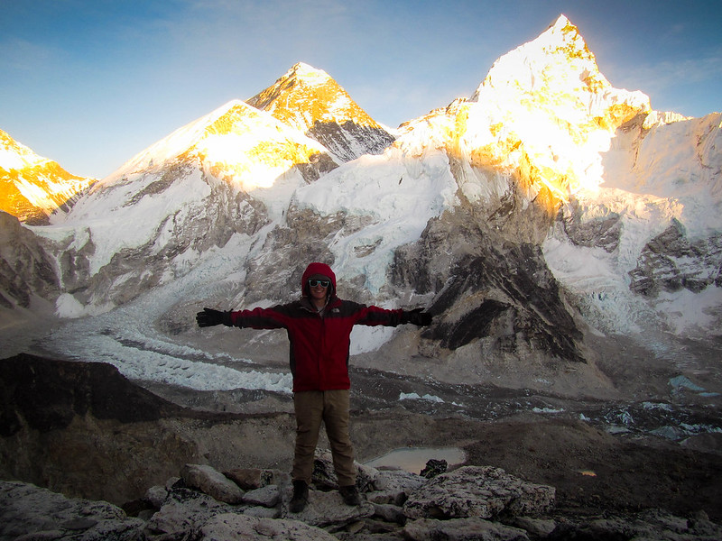
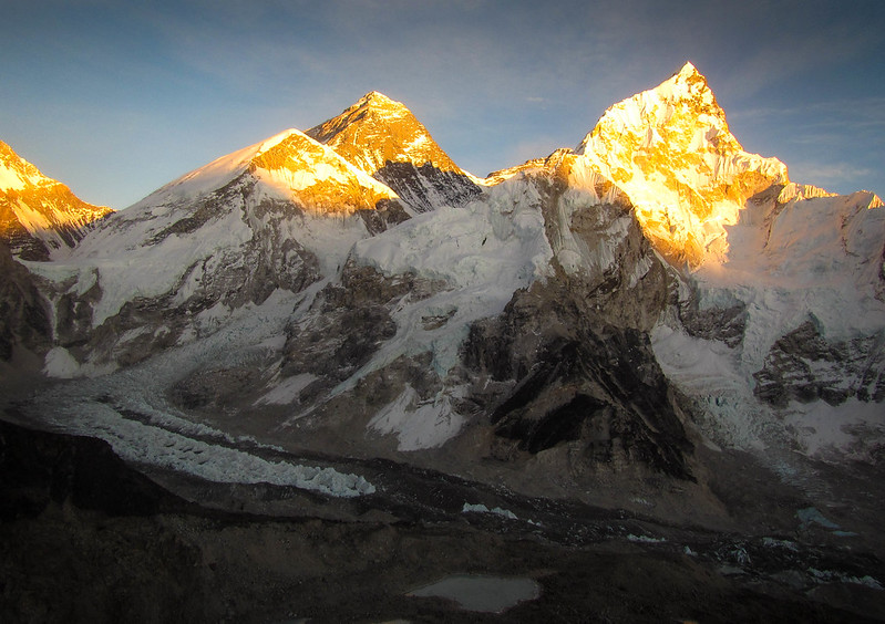
In contrast to the surrounding giants Kala Patthar looks fairly small, but from Gorak Shep it’s another 500 meter (1,600 foot) push. At sea level, another 500 meters would have been a piece of cake. But when you’re enduring the effects of altitude, it was a struggle. My pace was very slow–I’d take a few steps up and then pause for a second to catch up on breathing. It’s a weird sensation, experiencing the thinness of air. Not that I was gasping for it, but it just never felt like my lungs ever got full no matter how much I breathed in. The other thing about this particular hill were the false summits. Right when you thought you were nearing the top, you’d come over the ridge and find the true summit was still high above. It was disheartening as it seemed so far away. The silver lining to my slow progress however was by the time I actually had made it to the top, it was right around sunset and it was a perfect clear day. I climbed up onto to the summit block decorated in colorful prayer flags–at 18,514 ft (5643 m) it was the highest I’ve ever been. Even at this height, I was still a solid 10,000 feet (3,000 meters) below the top of Everest. From here you get a 360 degree panoramic view of the valley. Far down below, somewhere on the Khumbu Glacier, was the site of Everest Base Camp. And far up above, so close yet so seemingly far away, the summit of Everest basking in the orangish-pink alpenglow. Being lost in the moment, I barely noticed the heavy fatigue or biting cold of the strong winds whipping across in my face. A few of the others I had been walking with the past few days were also at the top and we shared the moment together.
After about 20 minutes of summit time, we headed back down. Going down was much quicker than going up, but at this point I had a throbbing headache and my legs were killing me. Stumbling back into the guesthouse, I went and threw on some more layers of clothes to keep warm and ordered some dinner in the dining area. From that point, things started going downhill from there. Aside from the headache and loss of appetite, my stomach also felt a bit off. I tried to force myself to eat and drink up some tea but it was no use. I felt terrible. I got really nauseous at one point and went outside and got sick. When I came back in, the guesthouse owner came over to check in on me and said he was a little worried about my condition. He suggested that if I didn’t get any better by the next morning, he’d offer to call in a helicopter. Although I had travel insurance, a $10,000 helicopter evacuation wasn’t something I was really keen on dealing with. I drank a couple cups of tea and headed off to bed for a much needed rest.
Day 9-13: Back to Civilization
Luckily, aside from another night of not getting a whole lot of sleep, I didn’t get sick again and managed to eat a small breakfast the next morning. The original plan was to wake up early and do the final stretch of the walk to the actual site of Everest Base Camp, but I opted to start heading back instead, satisfied that I had at least made it to the top of Kala Patthar (which is much higher than EBC and actually has a view of the summit). Initially the walk was a bit rough considering the condition I was in, stumbling over stones through the boulder field just outside Gorak Shep. I spent the whole day walking back from Gorak Shep to Dingboche, happy to return to that warm guesthouse and thaw out by the stove. I got a restful night sleep there and continued on the next day, all the way to Namche Bazaar. By now I was feeling much better. The oxygen-rich air of the lower valleys was so rejuvenating–I felt stronger with each step I took. It was amazing how much my overall mood and state of health had changed in just a day. After one last night in Namche, I walked the remainder of the way back to Lukla. What took 9 days to walk up only took 3 days to walk down, a total of 89 miles (124 km) to Everest and back.
My flight back to Kathmandu the following day got cancelled due to heavy fog that never lifted until the next day. I didn’t mind since I could at least relax and socialize with some of the other people I had been walking with the past two weeks. Luckily we were only “stranded” in Lukla for the one extra day. The day after that the weather was clear enough to fly and we were back in Kathmandu in no time at all.
One week after finding myself face-to-face with the highest mountain in the world, I found myself a world away in Paris. It was a weird sensation to be back in a western society after three and a half months of Asia. The last few weeks of clear, clean air and the silence of nature was replaced with crowded streets and hazy skies. I was very thankful however to be able to take a proper shower again and have a nice warm bed to sleep in. Ever since Nepal, I’ve never taken having a soft, warm bed to sleep in every night for granted again.
Doing the trek to Everest was something I had dreamed about doing for years and I was very happy to finally tick it off the bucket list. What a challenge. It was by definitely one of the hardest things I’ve ever done, both physically and mentally, but it was all worth it.
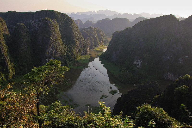
Culturally and aesthetically, Nepal is one of the most beautiful and amazing countries I’ve ever been to. As a lover of hiking and the mountain, it’s no surprise that it’s on my top 10 favorite places I’ve been to so far. Even today from time to time, I still daydream about those deep blue clear skies, the giant craggy snow-capped peaks, and the warm hospitality of the Sherpa people.


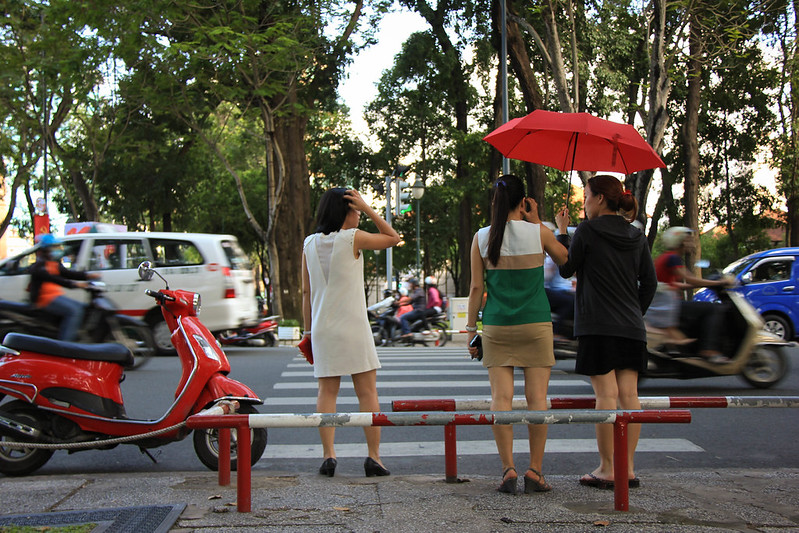
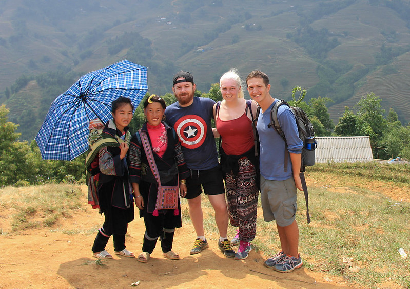
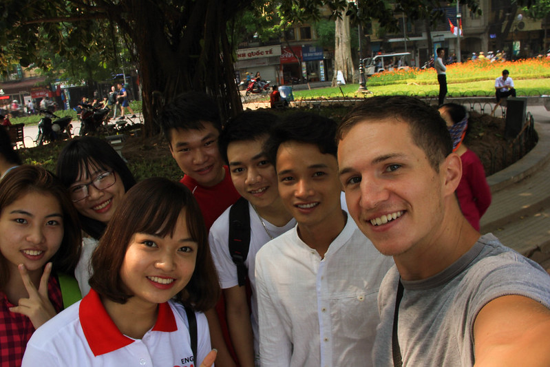 As an American in Vietnam, I wasn’t sure what the reception would be to locals I’d meet considering my country’s bloody history and involvement there in the past. While I didn’t find people there as friendly as those in nearby countries (mostly people from older generations), I generally got that the resentment was because I was a tourist not just because I was American. However, there were several times where I had positive interactions with people who seemed genuinely curious in where I was from and what I was doing in Vietnam. Oftentimes, especially while hanging out in city parks, university students would come up and politely ask if I could talk with them to help practice their English. I remember one particular group of college students who went out of their way to buy me ice cream (for those who know me, nothing makes my day more than free ice cream)! There will always be bad apples anywhere you go, but I like to think that there are more than enough good ones around to make up for it.